 Feds halt activist deportation
 'Smart' lawyer suspended
 First Nation solar farm plans
 Searching landfill for woman
 Poland urges more spending
 Cutting rates at own pace
 Israeli strike played down
 Full Trump jury seated
 World's largest election
  Lawsuit over missing nuts
 Investigating pipeline blast
 TikTok testing new app
 Warriors ready for Round 2
 Kalamalka Bowl cancelled
 Rockets live to fight on
 Hilton teams up with Sia
 Swift still 'can't forgive' Kim
 Grimes to ‘cap the disarray’


Flooding in Kelowna is nothing new.
While the floods of 2017 will go down as some of the worst Kelowna has ever seen, historic floods covered much more of the city.
What we don't know yet is just how high Okanagan Lake will get, and how far the water may seep inland.
Kelowna Museum has shared images from flooding dating all the way back to 1903.
While data is not available for many years prior to 1948, pictures tell the story of flooding from some of the earlier years.
High lake levels have been dated back to the late 1800s, although exact levels were not documented.
In 1904, a provincial paper on lake management indicated the lake achieved a level of 343.72 metres above sea level. This was before systems were put in place to regulate the flow of water from the lake.
The year before, in 1903, downtown streets flooded, as shown in the picture above.
In 1935, Marshall Street, which also flooded this year, experienced serious flooding from the overflowing Mill Creek.
And in 1941, CKOV Radio's transmission tower and building found itself surrounded by water from Mission Creek.
In 1948, the old wooden KLO bridge was destroyed by surging waters from Mission Creek.
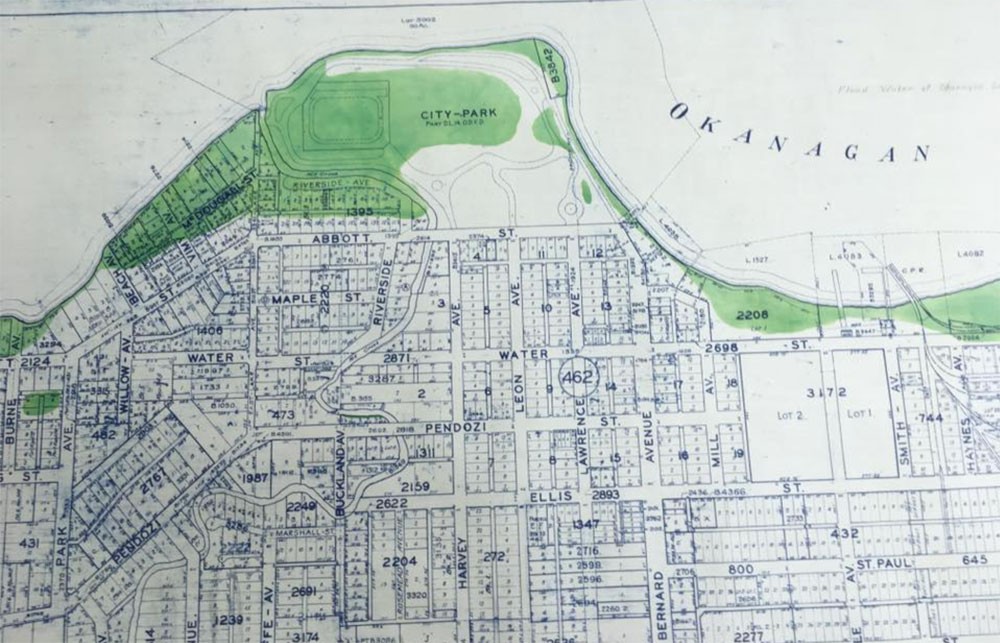
That year, a large portion of the downtown waterfront was also flooded. A flood map shows City Park virtually under water, as well as portions of Abbott Street, south of what is now the bridge, and Water Street where Stuart Park now sits.
Large flooding events were also experienced in both 1990 and 1997.


